There will be a risk for severe weather in Arkansas through at least Thursday, the National Weather Service in Little Rock said.
Tuesday night, June 23, much of the western half of the state will be under a Marginal Risk (1 out of 5) for severe weather. An additional round of strong to severe thunderstorms is possible across portions of Arkansas beginning this evening into the overnight hours and early morning of Wednesday. Damaging winds will be the main threat.

The Marginal Risk continues Wednesday for a large swath of the state. The main hazards Wednesday will include strong to damaging wind gusts from a cluster of storms moving southeast across the state.

The latest information that was available Tuesday afternoon indicated that the Arkadelphia area will be mostly in the clear by Thursday, when additional rounds of showers and storms are possible over mainly far northern portions of the state.

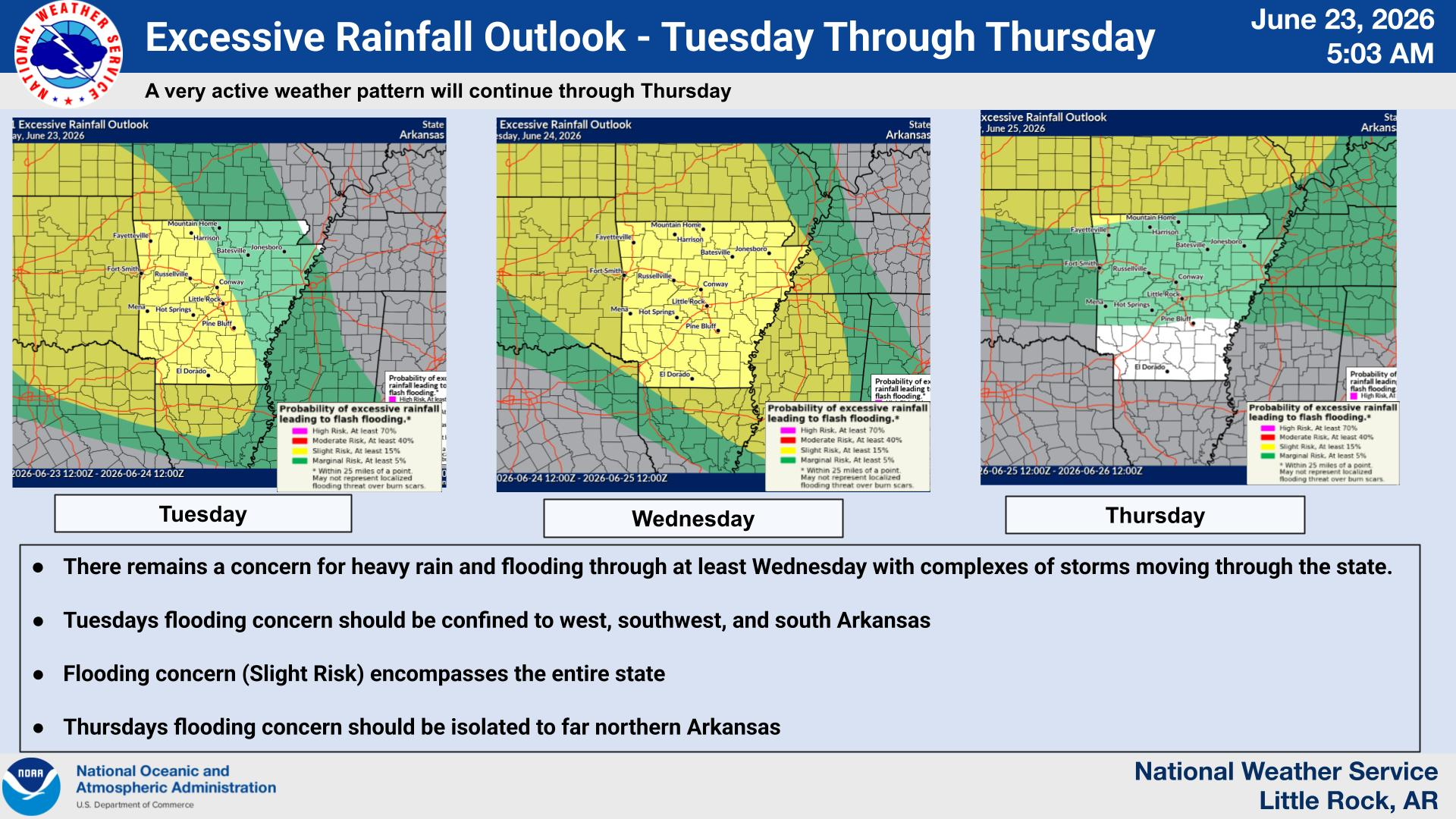
However, repeated rounds of showers and thunderstorms bring the risk for flash flooding. There remains a concern for heavy rain and flooding. Tuesday’s flooding concern should be confined to west, southwest and south Arkansas, and Wednesday’s flooding concern encompasses the entire state.
Arkadelphia’s forecast calls for rain and thunderstorms Tuesday night through Wednesday, with sunny skies returning Thursday and sticking around through at least Monday. Highs for the next several days will be in the mid to upper 80s, depending on cloud coverage and showers, with lows in the low to mid 70s.
Discover more from
Subscribe to get the latest posts sent to your email.