This post was updated Tuesday morning (Oct. 14) to include new information from the National Weather Service.
After a long dry spell with little to no rain accumulation, the stage is being set for Arkansas to receive scattered to severe thunderstorms this weekend as an upper level trough and associated cold front will sweep across the region.
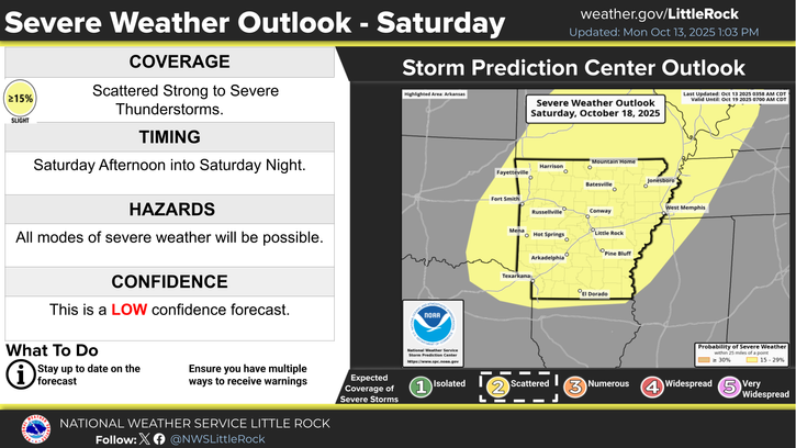
Scattered to severe thunderstorms are possible Saturday afternoon, Oct. 18, into Saturday night across the state. The National Weather Service in Little Rock says primary hazards will be damaging winds and large hail, but a few tornadoes cannot be ruled out.
Since posting the information on Monday, the NWS has upgraded its confidence in the forecast model from “low” to “medium”.
Until Saturday, the pattern favors dry and above average temperatures across the state, with lows in the 50s and 60s and highs climbing into the 70s and 80s.
The extended forecast for the Arkadelphia area has also been updated, increasing precipitation chances to 50% for Saturday and 60% Saturday night, with a high of 81 and a low of 56.
Sunday is calling for a 20% chance of showers under otherwise sunny skies and a high near 75 and a low around 49.
Discover more from
Subscribe to get the latest posts sent to your email.