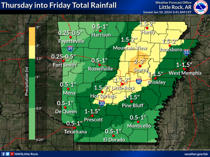

Another strong storm system will move across Arkansas toward the end of the week, the National Weather Service in Little Rock said Wednesday.
This system will bring rainfall potential ranging from 1/2 to 3 inches, with the highest of these amounts expected from central to northeast portions of the state.
Wind gusts on Friday into the night will be brisk ranging from 30-45 mph across most of the state.
Friday’s storm system will bring both rain and snow potential. As colder temperatures move into the state from the northwest, rain will transition to snow. Before the system departs, it may produce a trace up to two inches of snow over portions of western and northern Arkansas.
Precipitation will exit the state by Friday evening, with winds settling by late Friday night.
Extreme cold ahead
Meteorologists are monitoring two potentially impactful weather events through early next week.
After a brief lull this weekend from rain and snow, an Arctic front will make its way into the South, bringing well-below-average temperatures and potential for snow across much of the state.
By early next week, Arctic air will surge into the region from the northwest. This will result in below to much below average temperatures. Once cold air is in place, it appears that wintry precipitation will become more likely Sunday night into Monday. There is a potential for heavy warning criteria snow of several inches.
Discover more from
Subscribe to get the latest posts sent to your email.