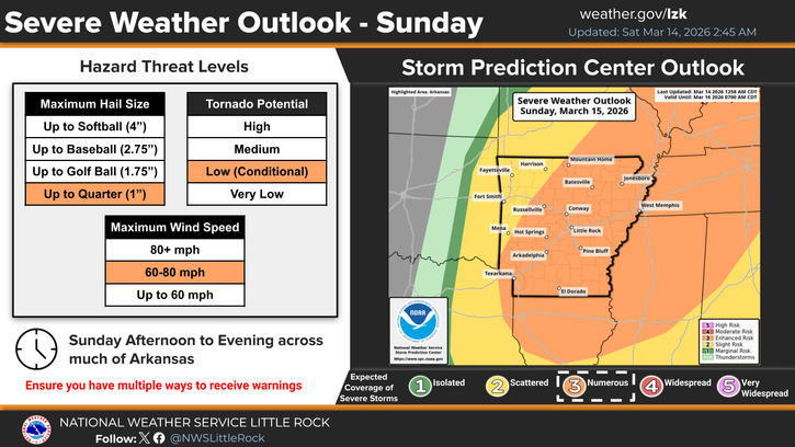
The National Weather Service in Little Rock is warning Arkansans to brace for severe weather Sunday, March 15.
A strong cold front will move southeast through the state on Sunday, with a line of strong to severe thunderstorms possible during the afternoon and evening hours. The primary threat appears to be damaging winds, with a couple brief tornadoes also possible along the leading edge of the thunderstorms.
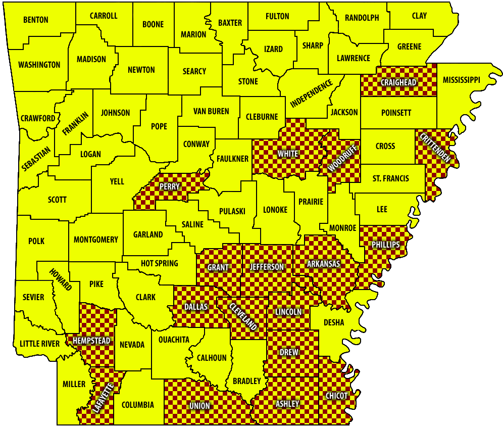
Eastern Arkansas is at most risk for the severe weather.
The high temperature Sunday will be 76. Chance of precipitation is 80%.
Showers and possibly a thunderstorm are expected after 1 p.m.
Strong northerly wind gusts Sunday afternoon could be as high as 30 mph for the Arkadelphia area.
Showers will continue into Sunday night, with some thunder possible.
As the cold front and storm system passes, unseasonably cold air will settle into the region. Subfreezing temperatures, including a hard freeze, are looking more likely Sunday night and Monday night. Those with new plants outdoors should bring them indoors or cover them.
Some portions across northern Arkansas may experience light snowfall and some accumulation as the storm system exits the state.
Though a forecast map shows no probability of snowfall for Arkadelphia or Southwest Arkansas, the extended forecast hints at a snow mixing with rain after 10 p.m. Sunday.
The low for Arkadelphia will be 25 Sunday night, followed by a cool Monday with a high of 44 and an even colder Monday night with a low of 22.
Daytime temperatures are forecast to warm again Wednesday, with a high near 70 followed by highs approaching the 80s later in the week.
Discover more from
Subscribe to get the latest posts sent to your email.