Monday and Tuesday should be the warmest days of the June 2-6 workweek, according to the National Weather Service in Little Rock.
Following two days with high temperatures reaching the upper 80s, there are chances for precipitation and thunderstorms for the remainder of the week.
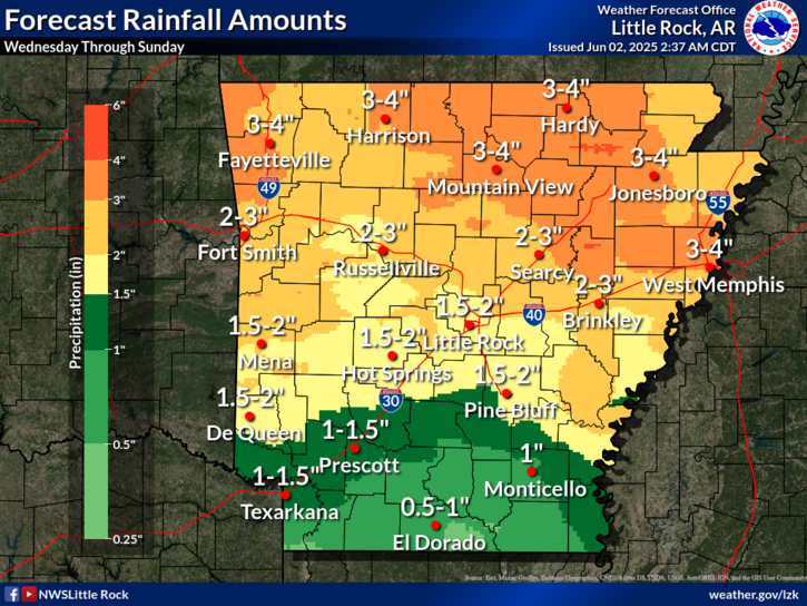
Forecast rainfall amounts for Wednesday through Sunday show several rounds of rain likely across the Natural State. The most rain is expected across northern locations with 2-4 inches possible. Central to southern locations can expected 1-2 inches of rain.
The first chance of showers begins in the pre-dawn hours of Wednesday and increase to 40% by Wednesday evening. A 40% chance of showers and thunderstorms returns Thursday under mostly cloudy skies.
Beginning Wednesday, daytime temperatures will be in the mid 80s, with nighttime lows in the mid to upper 60s.
Chances for rain and storms continue into the weekend.
Discover more from
Subscribe to get the latest posts sent to your email.