Joe Jeffers tagged along in 1957 to see his older brother off to college at Ouachita Baptist University. There was something about that “Wash-uh-taw” name that drew the seventh grader back to Arkadelphia, five years later, to pursue a college education.
Jeffers never really left — in fact, he retired in 2018 after a decades-long career at OBU, where he taught chemistry. Science aside, his curiosity about local landmark names prompted him to dig deeper and research the unusual monickers — L’eau Frais, Terre Noire, DeRoche and even DeGray. They’re all French names, but what do they mean? Jeffers aimed to find out.
The French arrived in what would later become the Arkansas Territory, in the 1670s, along with the Spanish, in search of gold. What they found was maize, but what they left behind — landmark names — has stuck around, three and a half centuries later.
By 1804 the Hunter-Dunbar expedition, dispatched by President Thomas Jefferson to explore the Ouachita River, recorded in their diaries many of the local French names they heard during their travels to study the “hot springs” in the foothills of the Ouachita Mountains.
“French place names and other colonial place names add richness to local history and culture,” Jeffers noted. “It is fortunate that signage preserves these names. Sadly, all such creeks are not signposted.”
Jeffers’s research was etched in the 2019 Clark County Historical Journal, an annual publication by the Clark County Historical Association. On Tuesday, Aug. 6, 2024, Jeffers presented his research at the Hollywood United Methodist Church. Here’s what those in attendance learned about French place names in Clark County:
Amity
From amitie, old French, means “friendly relations”. Named by William F. Browning, who served as the Clark County surveyor in the mid 1840s.
Antoine
Pronounced awn-twan and named after a dead Frenchman whose body was found on the river bank. This river forms the northwestern boundary of Clark County before it drains into the Little Missouri River near Okolona. Locals pronounce it ann-toine, rhyming with coin.
Caddo
From a Native American tribe the French called les Caddeaux. This river runs through Montgomery, Pike and northern Clark counties, entering the Ouachita near Caddo Valley.
Casa Massa
Also known as Cache Masse and Cachamassa — these spellings are likely a corruption of Cache a Macon. Hunters often had a cache, or hiding place, at the mouths of streams where they stored their pelts. This creek drains into the Ouachita near Dalark.
Deceiper
Pronounced deh-si-pee although locals say dee-seeper. From Bayu de Cyper, Bayou de Cypres, or Cypress Bayou. This creek south of Arkadelphia and east of Curtis flows into the Ouachita northwest of Sparkman. George Hunter of the Hunter-Dunbar expedition described large numbers of Cypress trees growing at the mouth of the creek.
DeGray
From de grés, same pronunciation, meaning sandstone. This name is given to the creek and community near Arkadelphia from which DeGray Lake is named.
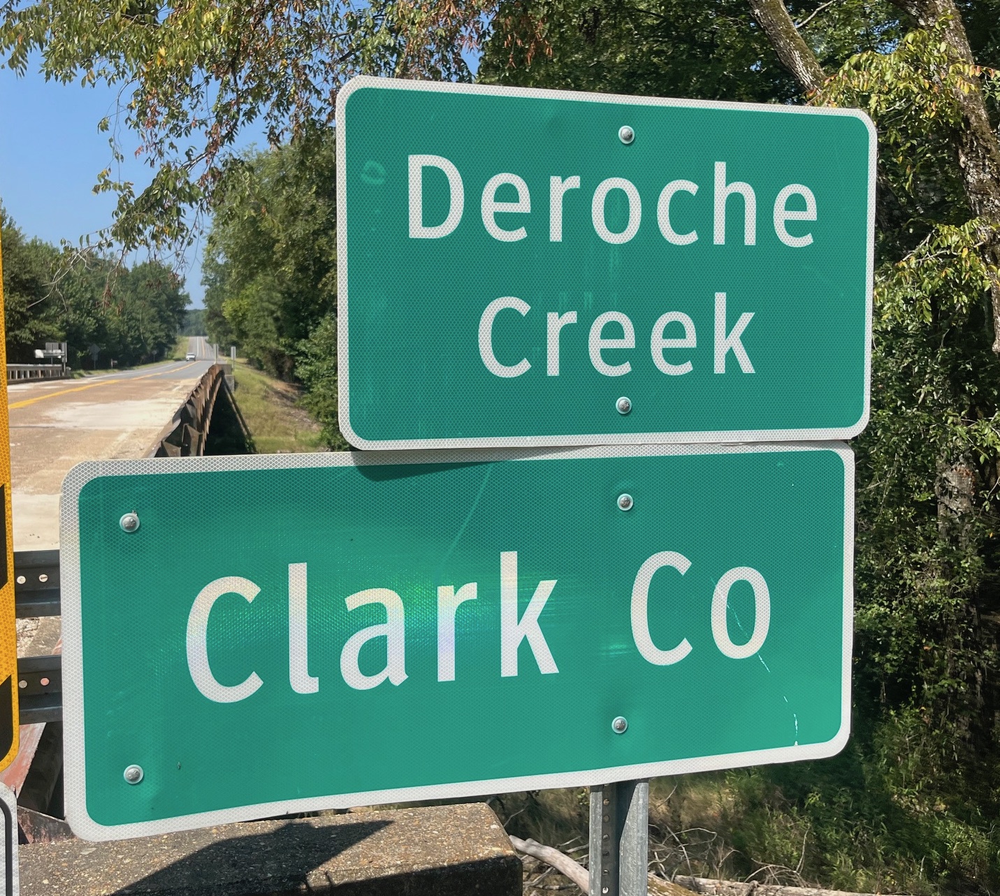
De Roche
Pronounced dee-roash both in French and by locals. From Bayu de Riches, or “Rock Creek”, this creek at the Clark/Hot Spring county line runs into the Ouachita just upstream from its confluence with the Caddo River.
L’Eau Frais
From French for “fresh water,” this creek east of Arkadelphia flows into the Ouachita near the junction of Arkansas Highway 7 and Manchester Road. Pronounced low-fray although some locals call it low-freight.
Ouachita
French say wash-she-ta although Arkansans pronounce it wash-uh-taw, it’s often written on old maps as Washita. It was the name of a small tribe of Native Americans that died out or became assimilated into other tribes about the time the first French explorers arrived. The name is thought to mean “Cow River People” and, in this case, cows refer to buffalo. This 605-mile river — the 25th longest in the U.S. — also shares a name with the mountain range in western Arkansas and eastern Oklahoma.
Terre Noire
Pronounced tere nwah as it rhymes with where rah, respectively. Locals call it turn-war or turn-wall. It means “black earth”. This creek runs through black soil north of Gurdon, entering the Little Missouri River just northwest of its confluence with the Ouachita, at Tate’s Bluff.
Terre Rouge
Pronounced tere roozh, meaning “red earth.” This creek, which begins in Hempstead County, runs through red soil as it crosses into Nevada and Clark counties before pouring into the Little Missouri River near Whelen Springs.
About the Clark County Historical Association
For more than 50 years the Clark County Historical Association has sought to advance the discovery, preservation and dissemination of knowledge about the county’s past.
The CCHA meets monthly at the historic Hollywood Methodist Church.
CLICK HERE for a list of upcoming events.
Discover more from
Subscribe to get the latest posts sent to your email.