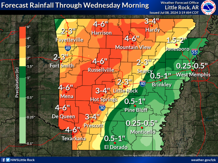

Hurricane Beryl has moved onshore early this Monday morning along the central Texas Gulf Coast, and is forecast to move northeast towards Arkansas by Tuesday morning, the National Weather Service in Little Rock reported.
The remnants of Beryl look to bring some areas of heavy rainfall and an increased threat for tornadoes to portions of Arkansas as what is left of Beryl moves over the state. There will be some increased threat for severe weather tonight into early Tuesday as the remnants of Hurricane Beryl move toward Arkansas. Damaging winds and some brief tornadoes will be possible with the strongest activity.

The remnants of Beryl will bring significant rainfall to much of Arkansas. The highest amounts will be located across northwestern half of Arkansas where 2 to 5 inches of rainfall are forecast through Tuesday night. Locally higher amounts will be possible. As a result, the threat for flash flooding will increase.

Forecast lows tonight into Tuesday morning will be in the low 60s to mid 70s.
Discover more from
Subscribe to get the latest posts sent to your email.