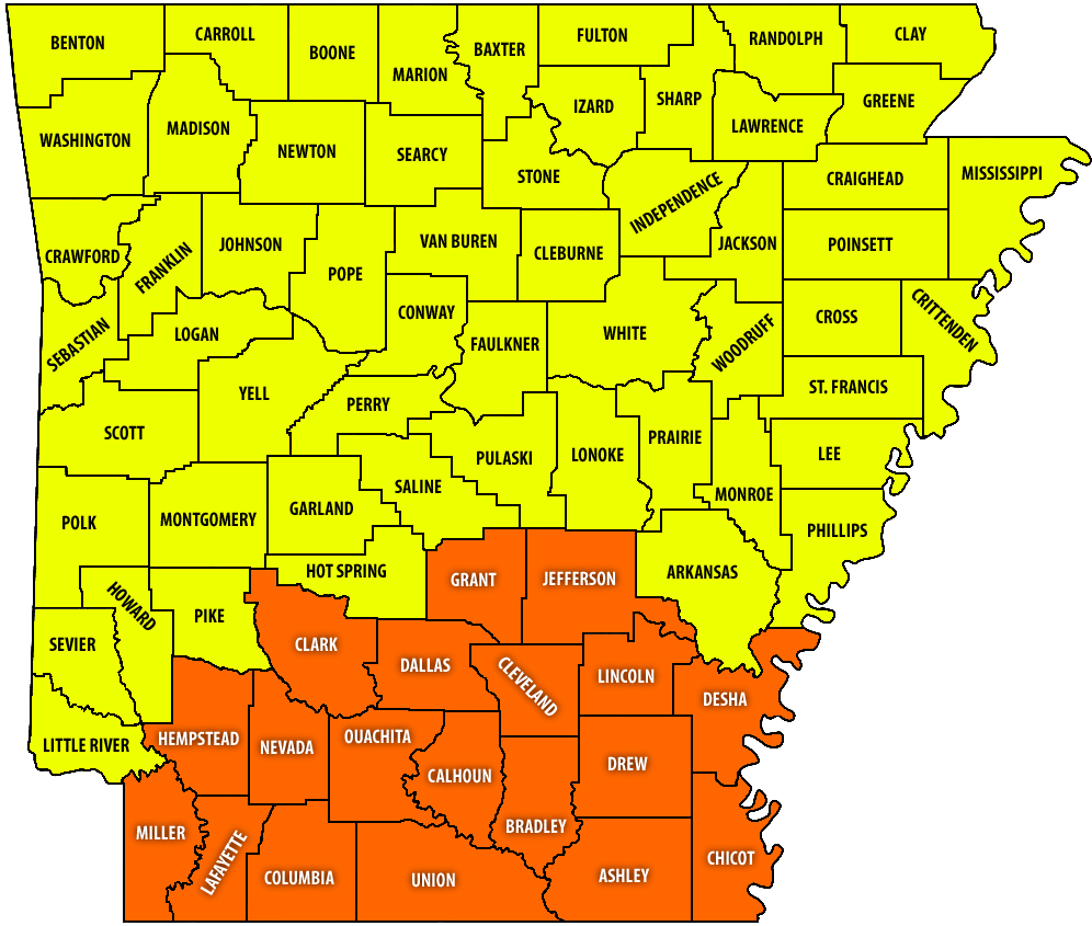

Most counties in the southern third of Arkansas are now under a High risk for wildfire danger, according to the latest map from the Arkansas Division of Forestry.
Burn bans remain in effect for most of those counties, including Clark County, as conditions worsen for the possibilities of wildfire growing out of control. The risk level increased from Moderate to High, meaning fires ignite easily and spread quickly. Fires may become serious if not attacked early.

The portion of exceptional drought in Arkansas has spread since the last report, with half the state now experiencing the worst measurable drought conditions.

Under these conditions, trees and wildlife are dying, cattle weights are low, and voluntary water conservation is implemented.
Chilly mornings, warm days ahead in dry forecast
There will be chilly mornings this week as the forecast calls for freezing low temperatures through Wednesday morning with a significant warming trend by midweek.
The National Weather Service in Little Rock says those daytime highs are expected to be 10 to 15 degrees warmer than seasonal average for this time of the year.
The next cold front moves into the state ahead of the weekend, bringing scant chances for rainfall statewide.
Locally, the extended forecast for the Arkadelphia area calls for daily highs in the low- to mid-70s through Saturday. After a chilly Tuesday night/Wednesday morning low of 36, nighttime temperatures are expected to be in the low 40s to low 50s through the workweek.
There are no local chances for rain in the forecast through at least Monday, Nov. 23.
Discover more from
Subscribe to get the latest posts sent to your email.