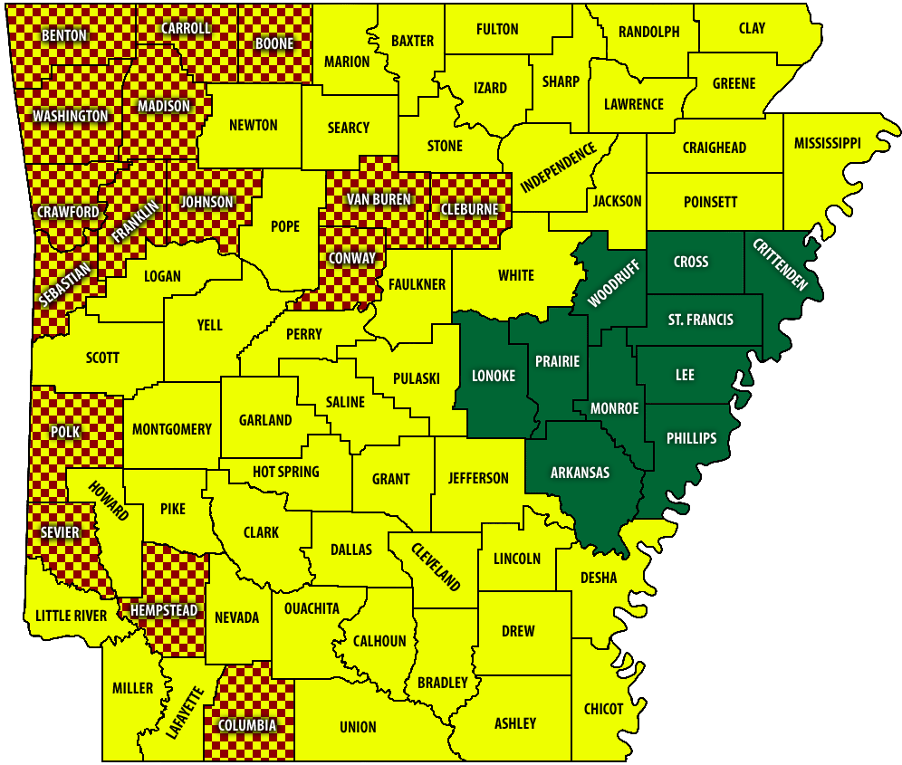
MAP: The latest wildfire risk assessment by county in Arkansas, posted Jan. 6, 2026. The map is subject to change daily. | Arkansas Forestry Division
The latest map posted by the Arkansas Forestry Division puts Clark County and most of the state under a Moderate risk of wildfire danger.
In recent days, some county judges in South Arkansas have issued burn bans: Polk, Sevier, Hempstead and Columbia counties.
Risk levels are determined by fuel conditions, drought status and long-term weather forecasts, and are categorized by how easily a fire can start and how difficult they are to contain. A Moderate risk means fires can start from accidental causes and, though they may not become serious, caution should be taken.
Drought conditions persist throughout the state. Some rainfall is expected Wednesday through Friday, though amounts will not be excessive.
The National Weather Service in Little Rock is forecasting a marginal chance of severe weather across Arkansas on Thursday afternoon and evening, Jan. 8, predicting that a few strong to severe storms will be possible. Gusty winds in excess of 60 mph will be the main threat, and could heighten the risk of fires getting out of control.
Discover more from
Subscribe to get the latest posts sent to your email.


